New Google Maps List Lets You Check Out Any Temple in the World
We’re not really sure where this list came from, but it’s pretty cool. It probably didn’t just magically appear, so hopefully this big “THANK YOU” can reach whoever constructed this handy tool. It’s an alphabetical list available through Google Maps of every temple of The Church of Jesus Christ of Latter-day Saints.
You just scroll to the temple you want to check out, click it, and satellite imagery of the temple pops up lickety-split (if it’s not in satellite mode, click on the green square in the bottom left-hand corner of your window to switch).
Worldwide LDS Temples

The list is called “Worldwide LDS Temples,” and you can check it out right now by following this link. When you click on a temple, you’ll notice that contact information pops up in a description box to the left of the map. If available, a link for further information from ldschurchtemples.com should also show up (though the site is currently under renovation right now).
If you want more than a bird’s eye view of the temple, you’ll have to click the “Get directions” button that appears to the right of the temple’s name above the description box. The button is circled in bright green below:

Once you push the button, a new window should open up that allows you map the quickest way for you to travel to that temple, but the new window also opens up another variety of features (also, notice the green “Satellite” button in the left-hand corner of your map).
Hover your mouse over the map portion of your screen and feel free to scroll (zoom) in or out, or click and drag your mouse to move the map.
My favorite feature is the “Browse street view images” option, which is represented by a small orange man figure in the bottom right-hand corner of the map. Click and drag the orange man onto any part of the map (presumably near the temple) and the imagery on your screen will be similar to what a person might see on the ground from that part of the street.
The orange man looks like this:

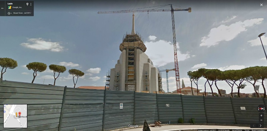
This is a view of the Rome, Italy temple from street view:

As you play around with this feature, you’ll see that if you need to adjust your view, you can click/drag on the screen, but you can also click farther down the street to check things out from different angles.
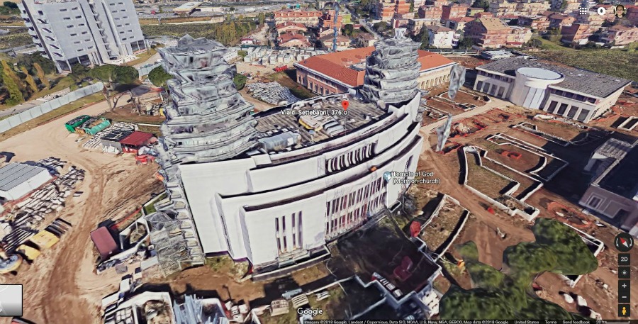
If you leave street mode and simply zoom in close to your target, something special happens. Some areas of the world offer 3D renderings of some structures. In Rome’s case, we get a pretty good 3D view of the temple (Temple Square in Salt Lake City is incredible). By holding down the SHIFT or CTRL button on your keyboard (sorry Mac users) and dragging your mouse, you can adjust your 3D angle without changing positions.
The 3D rendering looks something like this:

It’s important to know that this is not real-time satellite imagery. The small text on the bottom of the screen indicates it’s imagery from 2018, but that’s all we know. In these images, the temple is still under construction and scaffolding surrounds the temple spires. This may or may not be the case now. But still, it’s pretty sweet!
I’ve barely scratched the surface of the features Google Maps provides. There’s a whole list of control features for you to choose from in the top left-hand corner of your screen represented by three horizontal lines. So have fun exploring! Play around with the controls and check out all 185 temples (completed, under construction, and announced) like never before.
Here’s the link again in case you missed it previously.


